Reality capture shouldn’t be dangerous or difficult. Red Air Media helps to reduce the need for time-consuming manual inspections, helping to mitigate risk and keep field teams safe.
Aerial and ground views of construction in the Drone Deploy platform allows you to analyzes data from all reality capture sources.
SURVEY INSPECT MODEL
Drone topography survey
3D modelling
Thermal imaging
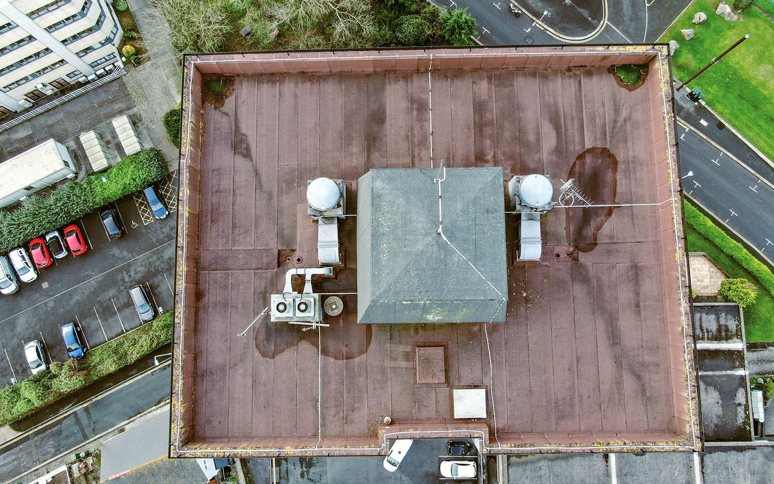
Roof inspection
Construction site progress


SURVEY MAPPING AND DATA COLLECTION
Working closely with housing associations, major building contractors and architects the Red Air team are leading the industry forward.
We can capture accurate bulk data on topographical surveys quicker than with traditional methods reducing both costs and time on the ground.
We can produce more accurate data capture with quick returns in digital output for use in Revit and other BIM software systems.
Survey mapping plays a vital role in various applications, such as urban planning, land development, and disaster response. Through aerial surveying techniques, professional Surveyors and Engineers can obtain high-resolution imagery and geospatial data to analyse and interpret the terrain. The data collected through aerial surveys provides valuable insights that help in decision-making processes and infrastructure development.
READ ON
Aerial Survey Techniques
Aerial survey techniques encompass a wide range of methods used to capture data from an altitude perspective. These techniques include the use of drones equipped with specialised cameras and Lidar technology for creating precise 3D models, and thermal imaging for detecting variations in temperature sensitive environments. By employing different aerial survey techniques, professional Surveyors and Engineers can gather a variety of data types for analysis and interpretation.
Lidar Technology for Aerial Mapping
Lidar technology has revolutionised the field of aerial mapping by enabling the creation of detailed and accurate elevation models. Lidar sensors mounted on aircraft emit laser pulses to measure distances and create high-resolution point clouds of the Earth’s surface. This digital aerial mapping technique is widely used in creating topographic maps, assessing vegetation cover, and analysing infrastructure.
Aerial Survey Drone Applications
Drones have become indispensable tools for aerial survey mapping due to their cost-effective nature and ability to access hard-to-reach areas. Commercial drones are equipped with specialised cameras and sensors that capture high-resolution images and geospatial data. From conducting roof inspections to monitoring vegetation health, drones have diverse applications in aerial surveying, Earth observation and accurate measurement data collection.
Sensor Technology in Drone Flights
Drone technology has revolutionised aerial survey mapping with the integration of advanced sensor technologies for enhanced data collection and analysis. These sensors play a crucial role in various applications, providing valuable insights across different industries.

Geospatial Data Collection with Drones
Drones equipped with geospatial sensors undertake data capture missions to gather a wide range of geospatial information. These sensors facilitate the creation of 3D models, terrain mapping, and spatial analysis, offering valuable insights for infrastructure planning and environmental monitoring.
Thermal Sensors for Infrastructure Inspection
Thermal sensors, including infrared and multi-spectral cameras, are employed for infrastructure inspection tasks. These sensors detect temperature variations in buildings, power lines, and other structures, aiding in the identification of potential issues and maintenance requirements.
High resolution Imaging and Analysis
Digital aerial mapping plays a crucial role in precision mapping techniques by utilising advanced sensor technologies to capture detailed imagery of the Earth’s surface. This method allows for accurate mapping of landscapes, infrastructure, and vegetation cover for multiple applications in industries like construction and environmental monitoring.
Engineer Analysis of Drone Survey Data
Engineers leverage drone survey data to analyse and interpret geospatial information for infrastructure planning and development. By utilising specialised software and tools, engineers can extract valuable insights from aerial survey data to make informed decisions regarding project designs and resource management.
Asset Inspection through High-Quality Imagery
High resolution imagery obtained through aerial survey mapping enables efficient inspection processes for infrastructure, buildings, and environmental assets. By analysing detailed aerial images, professional Engineers and surveyors can identify potential issues, monitor asset conditions, and plan maintenance activities effectively.
Applications and Case Studies
Applications of aerial survey mapping and drone flights have been demonstrated through compelling case studies that showcase the benefits of these technologies in real-world scenarios. From archaeological investigations using drone flights to infrastructure development with geospatial data. These applications highlight the versatility and effectiveness of aerial survey mapping techniques.


Geospatial Data for Infrastructure Development
The utilisation of geospatial data in infrastructure development projects enhances planning, design, and construction processes. By incorporating accurate geospatial information obtained from aerial surveys, engineers and planners can optimise project layouts, assess environmental impacts, and create sustainable infrastructure solutions that meet the needs of communities throughout the world.
Asset Management through Aerial Survey Mapping
Aerial survey mapping serves as a valuable tool for asset management by providing detailed information on asset conditions, locations, and maintenance requirements. By conducting regular aerial surveys and mapping activities, organisations can effectively monitor assets, plan maintenance schedules, and optimise resource allocation for improved asset performance and longevity.
OUR CLIENTS
…just a small selction

